
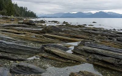
On the morning of June 23, 1946, an earthquake centred in the Forbidden Plateau area west of Courtenay brought down three of every four chimneys in Cumberland, Union Bay and Courtenay. At magnitude 7.3 it is still the largest historic earthquake on Vancouver Island, though not the largest this coast has known. The Vancouver Island earthquake map has three sources of shaking to explain: faults far offshore, the Juan de Fuca plate sliding under the island at the Cascadia subduction zone, and the island's own crust, where inland earthquakes sit closer to cities and happen more often.
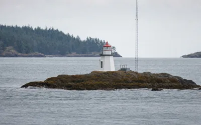
The water off Nanaimo is busier than it looks from shore. A line on paper runs from the light on Entrance Island to Five Fingers Island, and a ship crossing it is expected to call Victoria Traffic; marine traffic around Vancouver Island covers the two Coast Guard centres, the VHF sectors and AIS. Up the coast, off Nanoose Bay, the Whiskey Golf test range runs torpedoes and other test devices toward electronic targets, and boaters are expected to check whether it is active before they cross.
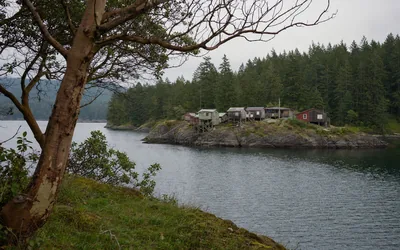
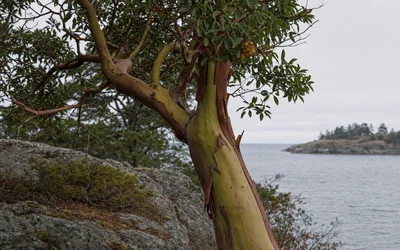
On land the bluffs belong to the arbutus, the only broad-leaved evergreen tree native to British Columbia, which sheds its bark in papery curls every summer at Neck Point. Pipers Lagoon Park, a 1983 purchase by the province, looks out on the small wooden buildings of Shack Island. Inland, Buttertubs Marsh is a 55 ha reclaimed wetland and floodplain on the Millstone River where painted turtles bask in the sun. Diver Lake, southeast of Brannen Lake, may owe its name to a mine collapse or to old miners' slang for a pickpocket, and the provincial record never decides which.
Some residents are recent arrivals. The black squirrels around Nanaimo are eastern grey squirrels in a dark coat, descended from an escape near Victoria in 1966.
The city's drinking water starts about 18 kilometres southwest of downtown, behind Jump Creek Dam. Nanaimo's watershed follows it down to the intake at South Fork, filtered since 2016, across forest land that is mostly owned by Mosaic Forest Management and that the city traces back to the E&N Land Grant.
All stories in Land & Sea
-
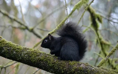
Introduced mammal
Black squirrels in BC: what the black squirrels around Nanaimo are
The black squirrels in Nanaimo are eastern grey squirrels in a dark coat, descended from an escape near Victoria in 1966. How to tell them apart.
-
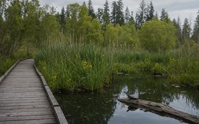
Urban wetland
Buttertubs Marsh in Nanaimo: painted turtles, yellow iris and a river
Buttertubs Marsh in Nanaimo is a 55 ha reclaimed floodplain on the Millstone River, home to painted turtles, a bird-banding station and a dogs-free trail.
-
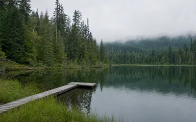
Urban lake and park
Diver Lake in Nanaimo: a coal-country lake, its park and its odd name
Diver Lake sits southeast of Brannen Lake in north Nanaimo. Its park has a fishing float and off-leash field, and its name may go back to a mine collapse.
-
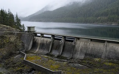
Municipal water supply
Jump Lake and Nanaimo’s watershed: how the city’s water is supplied
Nanaimo's water is stored behind Jump Creek Dam, taken in at South Fork and filtered since 2016, on forest land the city does not own.
-
Marine radio service
Marine traffic from Victoria, BC: Coast Guard radio, sectors and AIS
How the Coast Guard tracks marine traffic around Victoria, BC and Vancouver Island: two centres, VHF traffic sectors, calling-in points and AIS.
-
Waterfront park
Shack Island BC: Pipers Lagoon Park and the shacks beside the lagoon
Shack Island sits off the headland of Pipers Lagoon Park in north Nanaimo, a 1983 park bought by the province on a lagoon that once held a whaling station.
-
Native tree
The arbutus tree on Vancouver Island: where to see it in Nanaimo
Where arbutus trees grow in Nanaimo, how BC's only native broad-leaved evergreen tree survives dry rock, and what is behind the blackened leaves.
-
Geology, preparedness
Vancouver Island earthquake map: fault lines, history and local risk
The fault lines behind earthquakes on Vancouver Island, from the 1700 Cascadia earthquake to the 1946 quake, how to read the map, and what to do when it shakes.
-
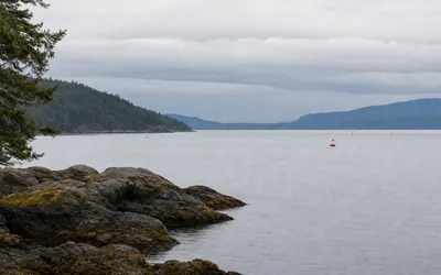
Sea, navigation
Whiskey Golf: the military test range off Nanoose Bay, for boaters
Area WG off Nanoose Bay is a torpedo test range. What happens there, when it is active, the safe transit route and how to check status by radio or phone.


Questions
Where can I see arbutus trees in Nanaimo?
The north-end waterfront parks are the easiest places. Pipers Lagoon Park has a mixed Garry oak and arbutus meadow on its rocky headland, and the loop trail at Neck Point Park runs through a similar mix. The City of Nanaimo's fact sheet on arbutus decline uses a photograph of a tree at Jack Point.
Why does Vancouver Island have earthquakes?
The island sits beside active plate boundaries. West of it, the smaller Juan de Fuca plate slides beneath North America at roughly 2 to 4 cm a year, and at depths shallower than about 30 km the two plates are locked by friction while strain builds. The Geological Survey of Canada describes three sources of shaking in the region: giant subduction earthquakes, earthquakes within the sinking plate, and earthquakes within the North American Plate itself.
Can boats cross the Whiskey Golf range off Nanoose Bay?
Not while it is active, unless Winchelsea Island Control authorises it. Testing usually takes place in daylight, Monday to Saturday, and status can be checked on VHF 21B or Weather 3, or by calling Winchelsea Island Control on channel 10 or 16. The Navy recommends a transit route 1,000 yards north of Winchelsea Island and 1,000 yards east of South Ballenas Island.
Who owns the land around Nanaimo's water supply?
Apart from the dam footprints, the reservoirs out to their high-water line, a small buffer and pipeline rights-of-way, the land does not belong to the city. The rest is privately held managed forest, mainly owned by Mosaic Forest Management, and the city traces the title back to the E&N Land Grant. Logging continues there under the Private Managed Forest Land Act, and the city and Mosaic meet each year to go over plans for the area.
Are the black squirrels in Nanaimo a separate species?
No. They are eastern grey squirrels with an all-black coat, and researchers who study the black form say the fur is the only difference. The species is not native to the island: it escaped from a game farm in Metchosin in 1966, and a provincial contact reported it in Nanaimo by 1998.
How big is Buttertubs Marsh?
The City of Nanaimo calls the whole complex a 55 ha reclaimed wetland and floodplain habitat on the south side of the Millstone River. A raised walkway divides it into the East Marsh and the West Marsh. Its clay-bottomed basin absorbs overflow from the river during high water, and painted turtles bask there in the sun. Other sources give smaller figures because they count only part of the conservation area.
Sources
- Arbutus, Sierra Club BC
- Nanoose Range, GlobalSecurity.org